


Riding the Canal Trail
Doug West's travels on horseback take him past the remnants of an early-twentieth-century attempt to transform Newcastle, Utah into an agricultural paradise

My family arrived in Utah in 1848, but I’m still a “comer” in St. George, Utah. My family’s long trek along the Mormon Trail from Nauvoo, Illinois to Salt Lake City doesn’t count for much in my adopted town. The “comer” label is especially true in the small town of Pine Valley, which I visit regularly to ride. The high honor of “local” requires a surname of Jones, Burgess, Gardner, Snow, Whipple, or another family name dating back to at least 1855.
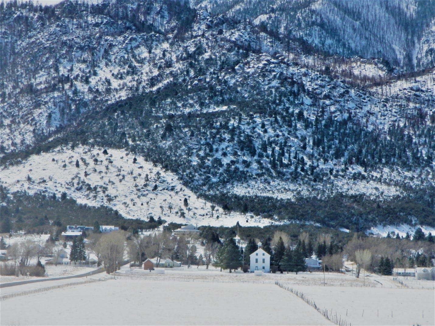
This small, historic Mormon community is beautifully situated on the west slope of the rugged, volcanic Pine Valley Mountains. These volcanic mountains dominate the view from the town on three sides, with Signal Peak towering above the valley at 10,364 feet. The Pine Valley Mountains are the largest known volcanic laccoliths in the United States and possibly the world. As a result, the trails are frequently steep and rocky—but traversing them comes with a reward, as they provide access to the 50,000-acre Pine Valley Wilderness.
I’m still exploring the many trails on the west and east side of the mountain. The trail names describe the rich history of the valley. When riding the Mill Canyon Trail, I imagine the once-operating sawmill producing lumber and shingles for the people then living in Pine Valley and St. George. Unfortunately, this once popular trail is now closed due to a wildfire that made it impassable for horses. When we did ride it, we could easily imagine the sawmill operating as we rode past the long-abandoned steam boiler that powered the mill. We could almost smell the sawdust and fresh-cut lumber. What I can’t imagine is how the old-timers got the lumber down this steep, rocky trail to the valley floor. To access the Summit Trail we ride Whipple, White Rocks, Water Canyon, or Pinto Springs from the west, or the Comanche Trail on the east side of the mountain. All these trails are rocky and steep. Once on the Summit Trail, you can ride forty miles along the backbone of the Pine Valley Mountains.
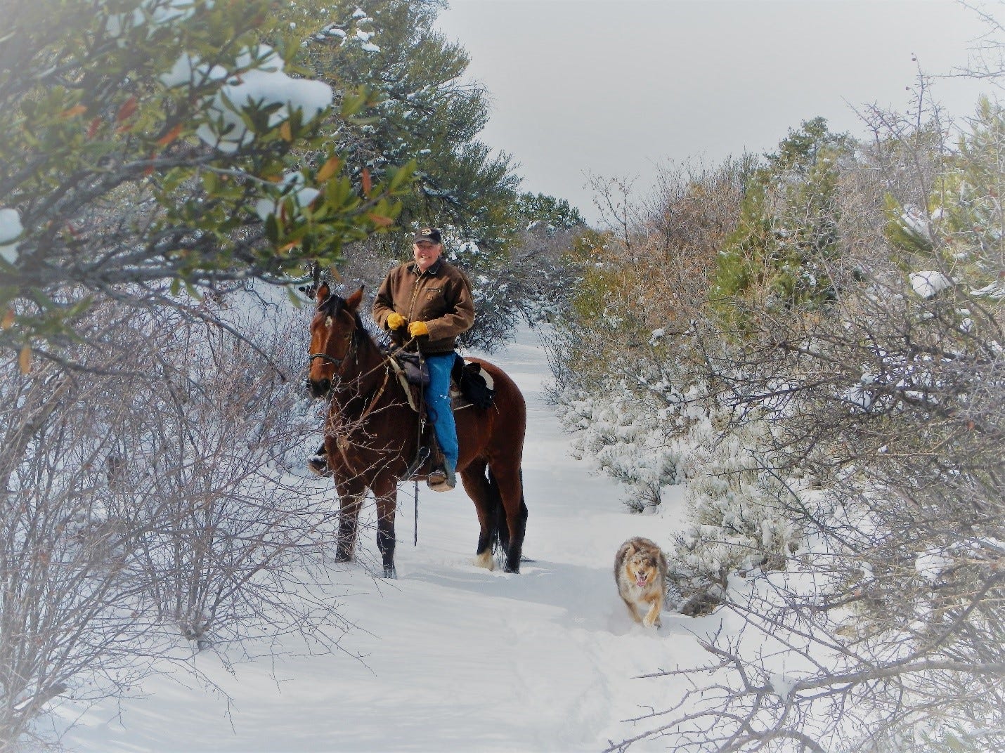
While not a very challenging ride, the Canal Trail’s history immediately attracted my attention. While riding the trail, I wondered how an approximately seven-mile-long, six-foot-wide, and six-foot-deep canal was built across a steep mountainside through hard volcanic rock. We ride in the bottom or on the banks of a deep ditch overlooking the pinion, juniper, and mountain mahogany trees. The first impression was that this trench shouldn’t be here. Referred to as the “China Ditch” by most locals, this seven mile stretch frequented by horses, hikers, and bikes was originally named the Highline Canal. It was constructed as part of the Newcastle Reclamation Project. The canal hangs on the north side of Pine Valley and is easily accessible from the Cemetery, Gardner Peak, and Equestrian Campground trail heads.
The Newcastle Reclamation Project started in the early 1900s. A group of northern Utah businessmen (“comers”) envisioned building a large agriculturally based community in Newcastle, Utah. It was not unlike the many developments still being built in the west today. Through private purchases and the federal Desert Entry Act, they acquired large blocks of land and platted their agricultural, utopian community. The Desert Entry Act allowed private parties to claim public land for private use, but required irrigation to make the land productive. The developers needed people to purchase the land and the water to irrigate it.
To attract potential buyers, the businessmen initiated an advertising campaign. Newspaper ads and brochures appeared around the country advertising the availability of cheap, rich, well-watered farm land. Interested buyers were picked up at the railhead and transported to the development in two new Cadillacs. They stayed in a recently built hotel on site, toured various properties, and were entertained.
Marketing was probably the easiest part of the project. For it to be viable, a complex irrigation system had to be built between two different water basins. Water had to be moved from the headwaters of the Santa Clara River south into the Colorado River and also north to Pinto Canyon where the water runs into the Great Basin. This engineering was not an easy task with the technology available in 1914.
While riding the trail alongside the Highline Canal, we talked with various horsemen and hikers about their knowledge of the canal’s origins. It is always surprising to hear the apocryphal legends that have been passed down over the hundred-year history of the Canal Trail. While discussing the trail with two other riders, one asked if all the Chinese laborers who had worked on the canal were killed. Another legend is that water ran through the canal only once or twice before it was abandoned.
According to Effie Gardner Beckstrom, who was a child at the time of construction, the canal was built primarily by Japanese laborers. The historical record confirms her account. Some Greek and Hungarian laborers also worked on this section of the project. Effie, now deceased, reported playing with the Japanese daughter of one of the bosses. She also recorded the death of a Greek worker. When riding the Canal Trail, I can’t help but be surprised that more men didn’t die. Almost all the work was done with picks, shovels, and black powder. We occasionally come across metal barrels that probably stored the black powder used to blast the rock loose, which was then removed by the Japanese laborers. Unfortunately, many of the artifacts have been taken by visitors. The seven-mile-long ditch cut through tough volcanic rock is a testament to the strong backs and determination of these men.
The canal (or trail) was cut through very rocky ground, but today follows a ditch bottom full of sandy sediment. Many areas are full of large, fallen rocks. But most of the trail is like riding a constructed bridle path with excellent, soft footing for horses. The canal was actually in use until 1935 (approximately twenty-one years), when it was abandoned due to maintenance and operational costs.
While the Canal Trail is the best-known part of the Newcastle Reclamation Project, two other features can be visited on horseback. Riding the trail northwest takes you into Grass Valley. The Grass Valley Reservoir was an important feature of the project. Water was to be stored in the reservoir from the Highline Canal, Mill Canyon (Grass Valley Creek), and Water Canyon. Both Mill and Water Canyons have trails leading to the summit. They are more easily accessible from the Grass Valley Road, but it is more interesting to follow the history on horseback. The reservoir was central to the project’s success. Water was to flow from the reservoir to a mile-long tunnel into Pinto Canyon. Using picks, shovels, and a wood-fired, steam jackhammer, local workers cut the tunnel through solid rock. An important geological problem was immediately discovered when trying to fill the reservoir. The reservoir was constructed on top of volcanic strata that was extremely porous. Basically, the reservoir leaked faster than it could be filled to push the water to the tunnel. This flaw meant that the canal system had to be extended and deepened for the water to reach the tunnel.
Needless to say, the Newcastle Reclamation Project was not a great economic success. The hotel burned down. The two Cadillacs were sold. Today, Newcastle is a small farming and ranching community of approximately 250 souls. It is not the large agriculturally-based city envisioned by those who built the Highline Canal, Grass Valley Reservoir, and connecting tunnel. Some water still runs through the tunnel in high-water years. A dream before its time, costs and water rights disputes probably doomed the project from the start. Even though the project never reached fruition, we have to admire the effort.
 |
|
Doug- thanks for sharing your experiences and this bit of history. My dad was raised in New Castle, his ancestors having moved there from the St. George area a few decades earlier. We spent many weekends visiting my grandmother there and exploring around Pinto and "The Lions Mouth" through the late 2000's. It's fun to read about such a little-known place.
The tunnel entrance is visible but not accessible.